
AI road condition monitoring India, continuous inspection, monsoon-calibrated deterioration
modelling, and compliance reporting for NHAI, state PWDs, and PMGSY rural road agencies.
Aligned to IRC, MoRTH, and NHAI HAM/BOT contract requirements.
India is building 50+ km of highway every day under Bharatmala and PM Gati Shakti — yet 71% of the network sits below state highway tier with no formal condition data. India highway inspection AI provides the unified data layer across NHAI expressways, state PWDs, and PMGSY rural roads.
AI pavement condition assessment India — outputs built for Indian engineering practice. Every IRI threshold, distress classification, and report format is configured to the relevant IRC standard, MoRTH specification, or NHAI contract requirement.
IRC:82-compatible distress outputs — cracking, rutting, ravelling, pothole count — for direct NHAI and state PWD reporting. Replaces traditional BRIMS survey cycle data.
Network-scale IRI calibrated to NHAI performance contract thresholds: Good <2.5 m/km | Fair 2.5–3.5 | Poor >3.5. Monsoon-specific deterioration curves applied per climate zone.
Distress detection and asset classification aligned to MoRTH standard specifications — the definitive reference for Indian road construction and maintenance practice.
Independent IRI and condition verification for NHAI concession oversight — supporting HAM annuity payment decisions and BOT performance bond monitoring.
Rural road condition outputs compatible with PMGSY OMMAS — enabling systematic quality evidence for Gram Sadak rural connectivity investments across all states.
Road safety audit and blackspot identification aligned to IRC:SP:19 methodology — supporting MoRTH's Road Safety Action Plan and Vision Zero targets.
AI road inspection software India — 6 agents covering every major
workflow, from IRC-compliant NHAI expressway reporting to
PMGSY rural assessment & post-monsoon emergency triage.
Network-scale IRI and IRC:82 distress classification from dashcam or LiDAR — monsoon-calibrated per climate zone
Network-scale IRI and IRC:82 distress classification from dashcam or LiDAR — monsoon-calibrated per climate zone
NHAI BRIMS-compatible; IRC:82 distress outputs; MoRTH specification-aligned; PM Gati Shakti GIS-ready
Dashcam video or LiDAR — no specialist survey vehicle required; scalable to state PWD and PMGSY networks
₹5,000–₹15,000/lane-km vs. ₹40,000–₹1,20,000 for traditional BRIMS survey
Post-monsoon rapid assessment + pre-monsoon baseline — two cycles per year minimum
Continuous independent IRI monitoring for NHAI concession corridors — Bharatmala and legacy BOT projects
Continuous independent IRI monitoring for NHAI concession corridors — Bharatmala and legacy BOT projects
IRI thresholds aligned to HAM annuity payment triggers and BOT performance bond conditions
Monthly compliance dashboards — annuity justification evidence and BOT performance default alerts
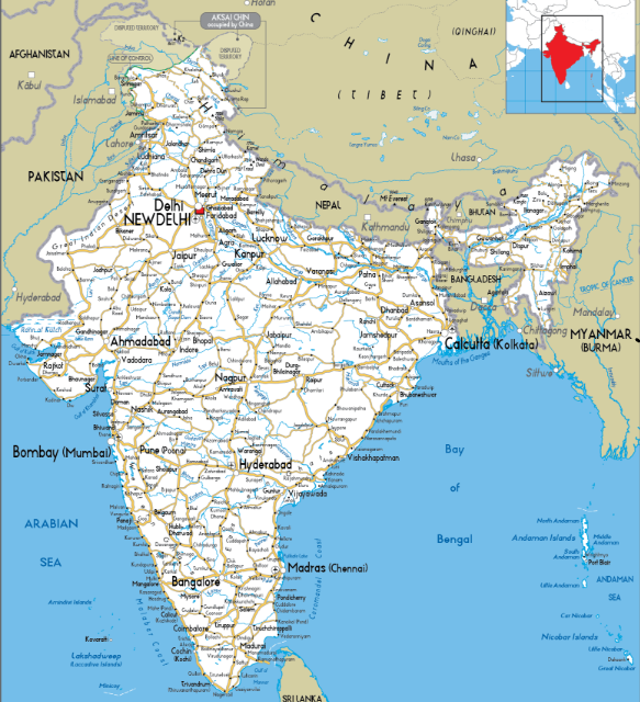
State and district highways across all 28 states and 8 Union Territories
State and district highways across all 28 states and 8 Union Territories
IRC:82 compatible; state PWD PMS integration; PM Gati Shakti data layer output
Condition evidence structured for state capital programme submissions and PMGSY quality reporting
Network-wide condition re-assessment at monsoon end — identifies critical deterioration before October–March maintenance window
Network-wide condition re-assessment at monsoon end — identifies critical deterioration before October–March maintenance window
All climate zones — humid (Kerala, Northeast), sub-humid (Gangetic Plain), semi-arid (Deccan), arid (Rajasthan, Gujarat)
Prioritised repair schedule for the full maintenance season; emergency NH closure alerts to MoRTH
Gram Sadak rural connectivity routes across all states — the 71% of India's network below state highway tier
Gram Sadak rural connectivity routes across all states — the 71% of India's network below state highway tier
PMGSY OMMAS-compatible condition outputs; quality evidence for rural road investment programmes
Systematic condition evidence replacing manual PMGSY quality inspection teams
Computer vision — pavement distress, roadside geometry, signage gaps, line marking degradation, sight distance
Computer vision — pavement distress, roadside geometry, signage gaps, line marking degradation, sight distance
IRC:SP:19 Road Safety Audit methodology; MoRTH Road Safety Action Plan targets; Vision Zero alignment
High-accident location scoring at network scale — replacing manual windshield audit with automated AI evidence
Traditional BRIMS survey costs make annual NH-wide coverage unaffordable & below tier, formal condition surveys are absent. AI highway inspection India changes unit economics for every tier.
Structured for GeM portal procurement, GFR-compliant tender processes, NHAI workflow integration,& deployment across monsoon cycles in 28 states and 8 UTs.
Benchmark AI outputs against your existing BRIMS or state PWD data.
Full state, NH region, or rural network coverage with monsoon-cycle updates.
Predictive scheduling replaces periodic BRIMS survey contracts.
Procurement: GeM portal · GFR-compliant tenders · NHAI · State PWDs · PMGSY agencies. Make in India compatible. NITI Aayog and MoRTH institutional procurement pathways available.
Whether you manage NHAI expressways, a state PWD network, Bharatmala corridors, or PMGSY rural roads — book a demonstration scoped to your programme, your IRC standards, and your MoRTH or NHAI reporting requirements. Includes AI road condition monitoring India and India highway inspection AI.